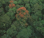
Vertical structure and aboveground biomass of tropical forests from large-footprint LiDAR.
Carbon emissions from deforestation and forest degradation have been estimated to contribute 12–20% of total anthropogenic CO2 emissions, ranking as the second largest source of CO2 to the atmosphere, after fossil fuel burning. Global monitoring of forest biomass is therefore critical to understanding the global carbon balance, and to support international agreements on greenhouse gases and carbon markets.
Currently, remote sensing approaches used for verifying carbon fluxes from forests rely heavily on passive optical systems (e.g. Landsat, MODIS), linking detected changes in forest area to average biomass values estimated from ground-based surveys. Although this method works well in temperate and boreal zones, where the average biomass is generally known through systematic forest inventories, it is subject to large errors in the tropics where biomass is poorly quantified. As a result, uncertainty in emissions from tropical forests is high for both annual values and trends, ranging from 25% to over 100%.
3-D remote sensing approaches that explore the underlying relationship between forest structure and biomass have shown improved performance in biomass estimation accuracy relative to nonstructural approaches, and will be an important component of any carbon-monitoring program. In this study, we exploit the analysis of space-based LiDAR observations from ICESat/GLAS, and detailed in-situ measurements of 3-D structure and aboveground biomass collected at the Tapajos National Forest, Brazil, to mature methodological approaches relevant to future earth observing missions such as DESDynI-R and ICESat-2. More specifically, our objectives are to:
- Test and refine methods for vertical structure estimation from large-footprint spaceborne LiDAR;
- Determine the accuracy of LiDAR estimates of structure in relation to detailed field measurements of 3-D structure; and
- Develop and validate structure-based models for optimal prediction of aboveground biomass.
References:
Drake J.B., Dubayah, R.O., Clark, D.B., Knox, R.G., Blair, J.B., Hofton, M.A., Chazdon, R.L., Weishampel, J.F. and Prince, S.D., 2002, Estimation of tropical forest structural characteristics using large-footprint lidar. Remote Sensing of the Environment, 79, 305–319.
Harding, D.J. and Carabajal, C.C., 2005, ICESat waveform measurements of within footprint topographic relief and vegetation vertical structure. Geophysical Research Letters, 32, L21S10.
Nelson, R., Ranson, K.J., Sun, G., Kimes, D., Kharuk, V. and Montesano, P., 2009, Siberian timber volume maps derived from MODIS and ICESat/GLAS data. Remote Sensing of Environment, 113, 691–701.
Sun, G., Ranson, K.J., Kimes, D.S., Blair, J.B. and Kovacs, K., 2008, Forest vertical structure from GLAS: An evaluation using LVIS and SRTM data. Remote Sensing of Environment, 112, 107–117.
Treuhaft, R.N., Chapman, B.D., Santos, J.R. et al., 2009, Vegetation profiles in tropical forests from multibaseline interferometric synthetic aperture radar, field, and lidar measurements. Journal of Geophysical Research, 114, D23110.
Treuhaft, R.N., Goncalves, F.G., Drake, J.B. et al., 2010, Biomass estimation in a tropical wet forest using Fourier transforms of profiles from lidar or interferometric SAR. Geophysical Research Letters, 37, L23403.